UN
5 Crossway
£ 735,000
Description
We don't have a Description for this property.
- Bedrooms
- 4
- Bathrooms
- 0
- Sqft
- 1,241.00
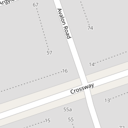

Leaflet © OpenStreetMap contributors
The heatmap indicates the level of crime in the area. The color of the heatmap indicates the crime severity and recency.
Metrics Year-on-Year
- Average area value
- 754,197.00 £Increased by 7.75 %
- Est sale value
- 1,025,066.00 £Increased by 226.48 %
- Average area rental value
- 2,319.00 £/moIncreased by 5.36 %
- Est letting value
- 2,482.00 £/mo
- Est rental Yield
- 3.69 %Decreased by 2.12 %
- Crime Rate
- 5.00 %Unchanged by 0.00 %
from 699,930.00 £
from 313,973.00 £
from 2,201.00 £/mo
from 0.00 £/mo
from 3.77 %
from 5.00 %
Nearby Schools
| Name | Type | Ofsted | Distance |
|---|---|---|---|
| Woodlands Academy | Academy Sponsor Led | Good | 0.40 KM |
| Castlebar School | Community Special School | Outstanding | 0.44 KM |
| Hathaway Children'S Centre | Children's Centre Linked Site | 0.48 KM | |
| Copley Close Children'S Centre | Children's Centre Linked Site | 0.69 KM | |
| Springhallow School | Community Special School | Good | 0.99 KM |
Images
Nearby Streets
| Name | Average Price | Average Sqft | Distance |
|---|---|---|---|
| Crossway | £ 993,500 | 0 | 0.00 KM |
| Argyle Close | £ 0 | 0 | 0.00 KM |
| Rutland Gardens | £ 850,000 | 0 | 0.00 KM |
| Cleveland Road | £ 1,109,667 | 0 | 0.00 KM |
| Hollingbourne Gardens | £ 1,850,000 | 0 | 0.00 KM |
Nearby Transport
| Name | NLC | TLC | Distance |
|---|---|---|---|
| Castle Bar Park | 3098 | CBP | 0.60 KM |
| Drayton Green | 3099 | DRG | 1.18 KM |
| South Greenford | 3138 | SGN | 1.23 KM |
| West Ealing | 3188 | WEA | 1.73 KM |
| Hanwell | 3191 | HAN | 2.06 KM |
Nearby Listings
| Address | Price | Type | Score | Distance |
|---|---|---|---|---|
| Brentside Close, W13 | £ 799,950 | BUY | 6 / 10 | 0.17 KM |
| Brentside Close, W13 | £ 1,000,000 | BUY | Unknown | 0.17 KM |
| Gurnell Grove, London | £ 470,000 | BUY | Unknown | 0.21 KM |
| Peal Gardens, Ealing, London, W13 | £ 895,000 | BUY | Unknown | 0.24 KM |
| Avalon Road, Ealing | £ 875,000 | BUY | 7 / 10 | 0.25 KM |
Nearby Properties
| Address | Price | Distance |
|---|---|---|
| 5 Crossway | £ 735,000 | 0.00 KM |
| 3 Crossway | £ 840,000 | 0.00 KM |
| 2 Crossway | £ 600,000 | 0.00 KM |
| 23 Crossway | £ 310,000 | 0.00 KM |
| 26 Crossway | £ 347,000 | 0.00 KM |